Cyclone approaches and puts PG on alert for storms and winds up to 100 km/h
Cold front maintains risk of heavy rain, hail and gusts of wind on Tuesday (22); Telêmaco Borba recorded winds of 95.4 km/h in the Campos Gerais

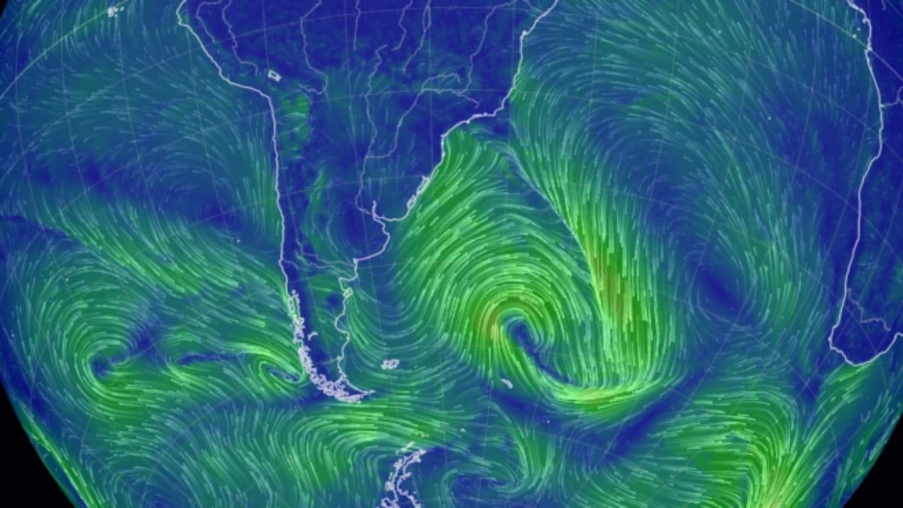
Ponta Grossa remains on alert for new storms on Tuesday, due to the action of a cold front associated with an intense extratropical cyclone in the Atlantic Ocean. The forecast indicates the possibility of heavy rain, electric shocks, hailfall and gusts of wind that can reach 100 km / h in different regions of the state.
The National Meteorological Institute (Inmet) issued an orange warning, which indicates danger for storms and covers virtually the entire territory of Paraná, with the exception of the extreme south. The instability comes after the storms recorded on Monday, when some cities of the Paraná faced intense winds.
Strong wind lifts car during storm in Francisco Beltrão; see images
In Apucarana, in the north of the state, the gusts reached 124.9 km/h, according to data from the Paraná Environmental Technology and Monitoring System (Simepar). In the Campos Gerais, Telêmaco Borba recorded winds of 95.4 km/h, demonstrating the intensity of the weather conditions that hit the region.
Ponta Grossa and Campos Gerais remain at risk of rain and wind
According to the Climatempo forecast, the cold front keeps the weather unstable on virtually the entire Paraná on Tuesday. The greatest potential for severe weather phenomena is concentrated in the north of the state. However, the central and southern regions also present favorable conditions for the occurrence of moderate to strong rain, lightning and wind.
In Ponta Grossa and in other municipalities of Campos Gerais, the population should remain attentive to weather updates, especially in the face of the possibility of rapid changes in weather conditions. Storms can cause disturbances, such as tree falls, power outages and flooding in vulnerable areas.
The wind alert of up to 100 km/h represents a forecast of maximum possible gusts in the areas covered by the warning, which does not mean that all cities will register this intensity.
Cold front loses strength and temperatures should drop
The forecast indicates a change in weather conditions as of Wednesday (23). With the cold front moving away, instability tends to lose strength on most of the Paraná. There is still the possibility of moderate to heavy rain, electric shocks and windstorms in the eastern end of the state.
In other regions, the trend is to reduce rainfall. After the passage of the system, a mass of cold air advances through the Paraná and causes temperatures to drop, especially during the early morning and early morning.
According to Climatempo, the thermometers can record minimums of 7°C in General Carneiro, Barracão and Palmas. In Francisco Beltrão, Pato Branco and Bituruna, the expected temperatures reach 8°C. During the afternoon, however, temperatures are expected to rise, with maximums that can reach 26°C in cities in the Northwest, West and Center of the state.
The forecast for Thursday is dry weather with no significant rainfall. On Friday (25), the trend is for more expressive warming during the afternoon, although mornings are still expected to have lower temperatures.
Care during the storms
Faced with the possibility of intense winds and electric shocks, the guidance is to avoid open areas and not seek shelter under trees during storms. It is also important to keep distance from fallen electrical wires, metal structures and sites subject to flooding.
Drivers should redouble their attention on highways and urban roads, especially in situations of heavy rain, low visibility and water accumulation on the track. In emergency situations, the population can trigger the Defesa Civil by phone 199 or the Fire Department by 193.